
First known printed map of Anglesey
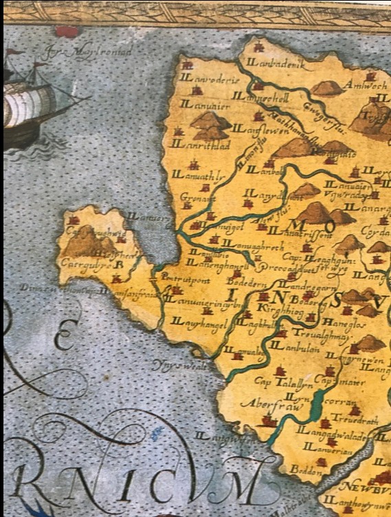
The earliest accurate printed map was created by Christopher Saxton around 1578–1579. Saxton was commissioned by Elizabeth I to survey and map the counties of England and Wales. His work is often considered the first national atlas of Britain.
The map shows Anglesey together with Caernarfonshire, and it was the first time Anglesey had been properly surveyed and mapped.
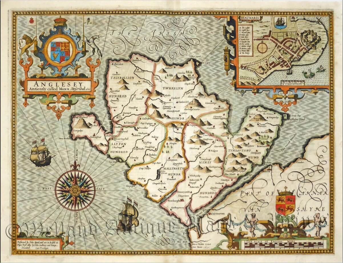
John Speed’s map of Anglesey (1611) is a decorative but surprisingly accurate depiction of the island for its time, showing towns, the coastline, and key geographical features while retaining artistic flourishes. It sits historically between Saxton’s functional survey and the later detailed tithe maps.
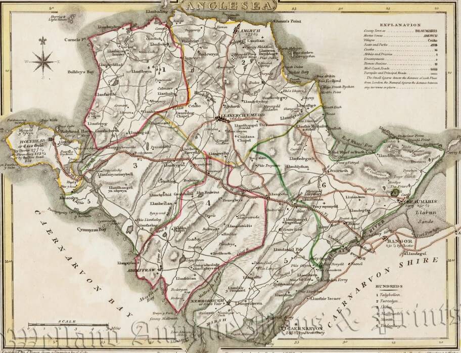
There was a notable old map of Anglesey from about 1809/1810 made by the English engraver John Roper, working with the cartographer George Cole. It sits historically between the decorative county maps of earlier centuries (e.g., Saxton, Speed) and the much more detailed tithe maps of the 1830.
The first turnpike roads across Anglesey were built from the 1760s onward, with smaller local routes initially. Turnpike roads were main roads maintained by trusts funded through tolls. On Anglesey they were linked by ferry to the mainland
From 1718 the post road ran directly from Porthaethwy to Penmynydd, and through Ceint, Bodffordd and Bodedern to Holyhead. By mid-century milestones were placed for the convenience of the light horse-drawn carriages now in vogue. Gwyndy, Llandrygan, built in 1758, became an important coaching inn acclaimed for its hospitality. It was here that the leading gentry, Bayly, Bulkeley and Panton, met in January 1760 to petition parliament for a turnpike-road. Trustees authorized to take over responsibility recouped their expenditure by charging tolls. Sanctioned by the Anglesey Turnpike
Act of 1765, the 26-mile post road was generally widened and improved and toll-gates erected at Braint, Llangefni, Llanynghenedl and Holyhead.
The old turnpike road between Menai bridge, Llangefni, Bodfordd and Holyhead is shown in the map above.It was narrow, often winding roads that followed old tracks, drovers’ roads, or estate routes.
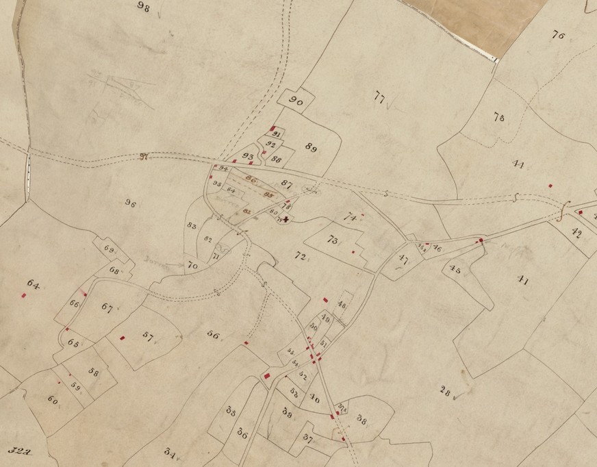
Tithe maps are historical maps created in England and Wales in the 1830s–1840s to record land ownership and land use for collecting church taxes called tithes.
A tithe was a tax—traditionally one-tenth of agricultural produce—paid to support the local parish church and clergy. This system existed for centuries in Britain.
After the Tithe Commutation Act 1836, tithes were converted from payments in crops (like wheat, barley, or livestock) into cash payments. To calculate how much each landowner owed, the government needed accurate records of land.
So surveyors created tithe maps and accompanying documents.
What a tithe map shows
- Boundaries of fields and plots
- Buildings, roads, rivers, and woodland
- A number for each parcel of land
Each number corresponds to a written record called a tithe apportionment, which lists:
- The landowner
- The occupier/tenant
- The land use (arable, pasture, orchard, etc.)
- The acreage
- The tithe payment owed
View Modern version of Trewalchmai Tithe map in detail
After the Tithe Maps (c.1836–1850), the next major development in mapping Britain was the expansion of detailed surveys by the Ordnance Survey (OS). These maps became the standard national mapping system and were much more precise and regularly updated than tithe maps.
6-inch maps (1:10,560) – first complete survey of rural Britain
1888 OS map of Trewalchmai East